QUICK SEARCH
MO PROJECTS:
Africa
Asia/Pacific
Mesoamerica
North America
South America
General Taxonomy
Photo Essays
Training in Latin
America
MO RESEARCH:
Wm. L. Brown Center
Bryology
GIS
Graduate Studies
Research Experiences
for Undergraduates
Imaging Lab
Library
MBG Press
Publications
Climate Change
Catalog Fossil Plants
MO DATABASES:
W³MOST
Image Index
Rare Books
Angiosperm
Phylogeny
Res Botanica
All Databases
INFORMATION:
What's New?
People at MO
Visitor's Guide
Herbarium
Jobs & Fellowships
Symposium
Research Links
Site Map
Search
The Classification of Natural and Anthropogenic Vegetation in MadagascarA NEW APPROACH TO VEGETATION CLASSIFICATION AND MAPPING IN MADAGASCAR In Madagascar, the application of the kind of careful, systematic analysis developed by White is critically needed. However, as White (1983) and many others have pointed out, a physiognomic classification for a given area must be developed and tested on the basis of direct field experience (although modern remote sensing techniques can serve as a powerful complement). More importantly, careful chorological analysis is absolutely dependent on a thorough understanding of the taxonomy of the native flora, and also on reliable specimen based distributional data (White 1993). Much work remains to be done before such an approach can be implemented in Madagascar, although the recent progress in botanical inventory work (now mostly being conducted by local collectors) and systematic studies by Malagasy and foreign botanists, is certainly encouraging.
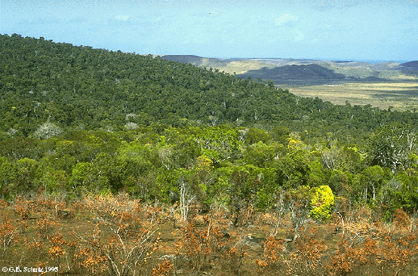
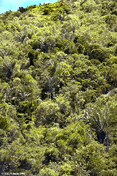
The application of White's approach to Madagascar would also result in treating all evergreen forests as a single broad physiognomic category -- whose distribution, largely coincides with the humid and subhumid stages indicated in blue and green on Cornet's map. Reliable chorological information would then potentially allow us to differentiate floristically distinct zones within these evergreen forests. If the ultimate goal of classification and mapping is to reveal
biogeographic patterns in order to recognize and delimit areas
that are biologically distinct, then chorology clearly must play
a central role. This certainly appears to be the case in
Madagascar, where one of the most important applications of a
vegetation map is for conservation planning.
|